
Technological Challenge
A 3-D geomodelling software (surface representations) that is capable of combining geological and geophysical data with Geospatial Building Information Modeling (GeoBIM) systems. It should be pos-sible to integrate various types of geological and geophysical data (especially borehole data, seismic data, other types of geophysical surveys, fault information) with typical BIM information for infra-structure and building information. Essential is a tight integration of both geological and geophysical modeling and the GeoBIM system to enable automated updates of models and visualizations. A link to VR/AR systems should be integrated.
Several companies offer GIS systems with BIM integration – mostly under the concept of Geospatial BIMs (GeoBIM). These systems also provide technology for VR/AR visualization. Especially the tight integration of various data types is still challenging in systems available today. Visualization of 3-D geological models is often possible in 3-D views on Desktops and increasingly implemented in VR/AR systems. The feedback between geological modeling methods and (Geo)BIM systems is, however, to date very limited.
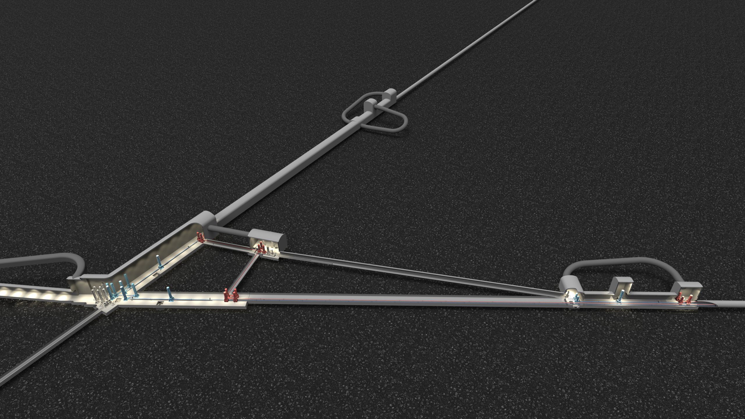
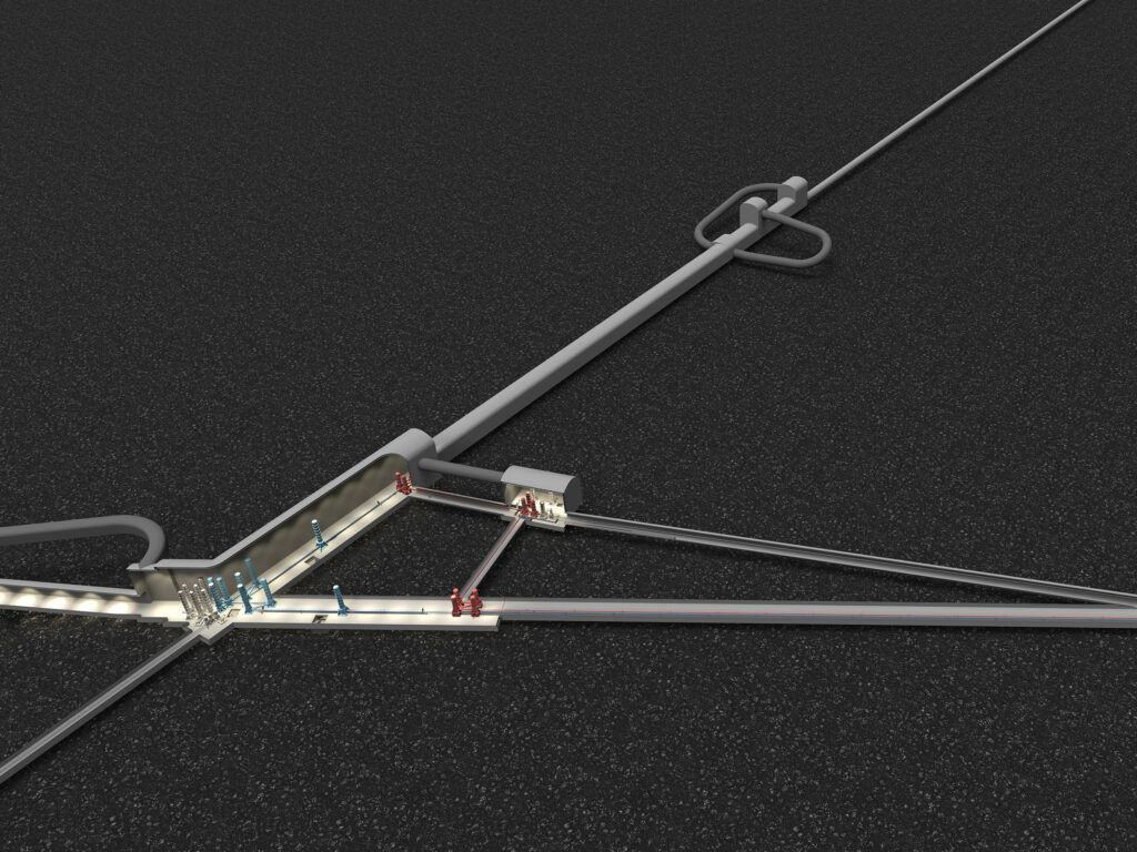
Relation to the Einstein Telescope
Relation to the Einstein Telescope
The construction and operation phase will require a system that enables a tight integration of engi-neering and geoscientific information. Considering the long term of the project, it is essential that the system enables frequent and, as much as possible, automated model updates for planning and visua-lization. Specifically, it should be possible to update the geological and geoscientific content in a Geo-BIM system during the project. The VR/AR component is also important for outreach activities and links to the technology item on VR/AR visualization.
Innovation
An extension of existing GeoBIM systems to geological and geophysical modeling and simulation environments.
Industrial relevance and further application fields
There is a potential of integration of geomodeling technologies in GIS systems, e.g for agricultural issues (remote sensing data, agriculture cadastre linked with geological data, soil structure). Other application fields can be found in hydrogeology, engineering geology, exploration of deposits (also open-cast mining post-use), geothermal energy.
We are open to any other companies’ proposals.

Agriculture
Remote sensing data, agriculture cadastre linked with geological data, soil structure, …
Engineering geology
Hydrogeology
References
For further information and more details about this technology field, please check the following Einstein Telescope Design Reports.
E-TEST Conceptual Design Report:
Einstein Telescope Conceptual Design Report:
Site and Infrastructure: Pages 161-192
Contact to the Einstein Telescope ecosystem
Are you active in this field of technology? Do you have an innovative approacht to meet the requirements for Geomodeling and GeoBIM integration? Then take note of our tenders, join our challenges or simply get in contact with us. Furthermore, you can take a look at the mapping displaying the ET-relevant cempetencies in the EMR-Region. If you would like to be part of this mappink, please contact the business development managers.
Business development contacts
Peter Gier
AGIT DE – p.gier@agit.de
Matthias Grosch
NMWP.NRW DE – matthias.grosch@nmwp.de
Michel Stassart
Skywin BE – michel.stassart@skywin.be
Annick Pierrard
ULiège BE – a.pierrard@uliege.be
Maxime Corvilain
POM Limburg BE – maxime.corvilain@pomlimburg.be
René Kessen
LIOF NL – rene.kessen@liof.nl
Scientific contacts
Florian Wellmann
RWTH Aachen University (DE) – wellmann@aices.rwth-aachen.de
Hans-Balder Havenith
Uliège, Geo-Env (WAL) – HB.Havenith@uliege.be